


AI Visual Monitoring + Security Integration
 System Introduction
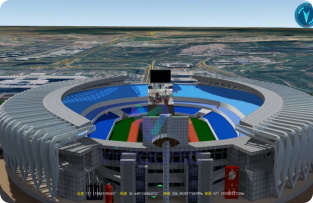
This system integrates AI visual recognition and GIS positioning technology to build a digital Li Sheng system, achieving 3D real-time real-life twin display. By integrating intelligent analysis, video, and IoT perception, we provide users with a comprehensive and accurate monitoring experience.
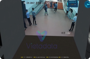
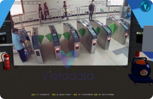
 Usage Effect
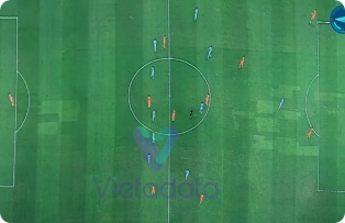
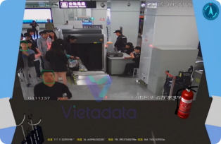
The AI vision system recognizes the scene in real time and processes alarms, and the information is transmitted to the GIS system in real-time. GIS combines location information to quickly locate and obtain relevant geographic and transportation information, optimize emergency response routes and plans, and improve visualization and response efficiency.